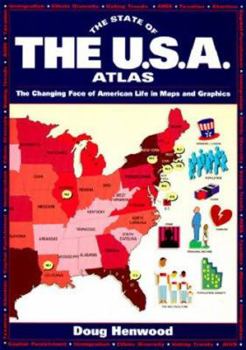
The State of the USA Atlas
Select Format
Select Condition 
Book Overview
This interesting study of the early American press and President Adams first discusses the fourth estate's treatment of President Washington. The newspapers of the day, alien in both form and content to today's publications, are also covered. The confrontational relationship between Adams and editors is examined, focusing on the President's personality, the "honeymoon" at the beginning of his administration, the increasing politicization of editorial...
Format:Paperback
Language:English
ISBN:067179695X
ISBN13:9780671796952
Release Date:January 1994
Publisher:Simon & Schuster
Length:127 Pages
Weight:0.75 lbs.
Dimensions:0.4" x 6.9" x 9.7"
Customer Reviews
2 ratings
The US at a Glance
Published by Thriftbooks.com User , 19 years ago
This book presents a graphical portrait of US demographics and political issues in the 1990s. Specific topics covered include population, immigration, manufacturing, the environment, labor, income, taxes, health, marriage, literacy, gay rights, crime, punishment, religion, and military spending. The main portion of the book is organized into two-page spreads, consisting of a color-coded map of the US adorned with graphical symbols showing where the topic under discussion is widespread or highly popular. On the margins of the pages are further graphical representations of related subtopics, and the legends for the main maps (which can sometimes be hard to find). Following the map section is a shorter section of tables, summarizing the same data from the maps state-by-state in numerical form. The last quarter of the book is devoted to presenting notes and sources in a manner similar to an annotated bibliography, where the order of presentation corresponds to the topics found in the map section. The graphical presentation of information in this book is very creative as well as highly informative. Readers can learn a tremendous amount of information about the culture of the US through studying these maps, and have much to discuss. (For this reason, the book would make an excellent background text for an intermediate or advanced ESL discussion course.) With the 2004 election on my mind, I kept looking for patterns in this book that would correlate with the infamous red and blue states. No, the distribution of personal income, taxes, and health do not correlate at all with the old red and blue. There is one map that is close, the one showing states with civil rights laws for gays. From this matching, we can surmise that it was indeed the liberals who voted against Bush in the 2004 election. It would have been much more fun to find some more correlations, say in the area of literacy or crime, but that's all there is. In general, the book, while slightly dated at this point, is very well designed, and well worth reading.
Political Education Made Fun and Easy
Published by Thriftbooks.com User , 24 years ago
In this modern day and age, many people often say they don't have enough time to keep up on current affairs and political issues and crises facing the United States.Though the State of the USA Atlas is no sure-fire substitute to keeping oneself informed of fast-breaking statistics and trends on any number of issues, it provides a way to educate oneself about the state of the nation in a fun, easy fashion, and lets you know why we can't afford to be ignorant about what's happening to people across our country. The atlas contains a series of 34 maps of the US, each map highlighting a different sociopolitical issue, such as ethnic diversity, education, immigration, farming, global trade, poverty, health care, gay and lesbian rights, AIDS, campaign financing, and religion, as well as incarceration and execution rates.I liked this atlas because it is accessible to readers from a variety of ages, as well as levels of experience and understanding, whether the one is a elementary school student, or one with a more sophisticated understanding of the issues. But even if you think you know it all, this book shows you that you probably don't...The use of color and graphics in the mapped presentation of the information is so effective that one is drawn into an overview of the information in a way that could not be conveyed in a newspaper or journal article. I've used these maps in teach-ins, classes, and workshops, and found them to be very eye-catching and popular with audiences of all ages and backgrounds.Everyone will learn something new through poring over these maps. For those with no background on the issue, each atlas has an accompanying explanation/commentary that summarizes the factors that contribute to different socioeconomic conditions. Most maps also provide a global context by offering the corresponding statistics from various nations around the world. Of course, statistics from each of the 50 states are included as well.This book is similar to the State of the Earth atlas, which offers a look at these issues on a global level, broken down by country. I can't recommend these atlases enough. However, the main drawback of The State of the USA is that the information has become outdated. As it was published in 1994, anyone can guess that the exact stats are already inaccurate. However, this does not invalidate or undercut its use. When using the book in conjunction with current data sources, as well as a healthy dose of alternative media sources with the stories of people facing these issues on a daily basis, one can gain an enormous amount of knowledge about any given issue from one map alone.


