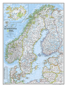
National Geographic Scandinavia Wall Map - Classic - Laminated (23.5 X 30.25 In)
National Geographic's wall map of Scandinavia is one of the largest and most detailed maps of the region. The signature Classic style design uses a bright, easy-to-read color palette. This map features thousands of place names, accurate political boundaries, national parks, and major infrastructure networks such as roads, superhighways, airports, canals, ferry routes, and high-speed and passenger railroads. The region's diverse terrain is...
Format:Map
Language:English
ISBN:0792292677
ISBN13:9780792292678
Release Date:September 2019
Publisher:National Geographic Maps
Length:1 Pages
Weight:0.95 lbs.
Dimensions:3.1" x 3.1" x 37.0"
Customer Reviews
0 rating


