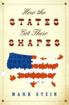
How the States Got Their Shapes
Select Format
Select Condition 
Book Overview
Mark Stein is a playwright and screenwriter. His plays have been performed off-Broadway and at theaters throughout the country. His films include Housesitter, with Steve Martin and Goldie Hawn. He has... This description may be from another edition of this product.
Format:Hardcover
Language:English
ISBN:1606711458
ISBN13:9781606711453
Release Date:January 2012
Publisher:MJF Books
Length:352 Pages
Weight:0.97 lbs.
Dimensions:6.0" x 8.0"
Related Subjects
Historical Study & Educational Resources History Social History State & Local TravelCustomer Reviews
4 ratings
Shapes of States...Why is that border there?
Published by Thriftbooks.com User , 16 years ago
I love this book! It is well-written in a straight forward yet interesting manner. I am sort of a map nut/geography/ history fanatic. We carry the book in the car to read when we are driving around and I plan to include the book in the resources for my social studies classes. It's a fun book to keep in a guest room or in the bathroom. The information about the creation of boundries is also useful in genealogy research. I plan to give the book as a gift to many people.
Enjoyable tidbits
Published by Thriftbooks.com User , 16 years ago
Driving though Northeastern PA, I often passed a historical marker describing that the area was CT in the mid-18th Century. So, when I saw this book, I purchased it initially so that I could learn more about this intriguing part of history. This book is enjoyable and informative and helps the reader make sense of aspects of American history. It is structured so that you can pick it up now and then and read various state histories when your time and inclination permit. Not only did I learn about PA and CT, Plymouth versus Massachusetts settlements, Jefferson's ideas, and various latitudes, but I was fascinated by the anti-Mormon and pro- silver and gold sentiments that created Nevada; why Alabama and Mississippi look like mirror images; the various notches in state borders, the importance of rivers, and so much more.
It Delivers!
Published by Thriftbooks.com User , 16 years ago
The contents of this book are well described in other reviews. My only addition is to say that, as a total geography buff with low tolerance for chintzy illustrations in books that purport to be on that topic, I was not disappointed at all. There are 179 illustrations (i.e., maps), showing the "geographic" development of each state. The maps contain just enough detail; any more would have expanded the size of the book beyond usefulness as a 50-state overview. Some reviewers have criticized the alphabetical organization of the book, which necessitates a fair amount of cross referencing to other chapters (e.g., "See Figure 153 in SOUTH DAKOTA"), and suggested that it be organized instead by region (Northeast, Mid-Atlantic, etc.). This is a fair criticism, but in the end I think it boils down to personal taste. A regional organization probably would have required reading lengthy exegeses of regional developments, which would have turned this into a history book. As it is, it is a complete, concise, and copious survey of the topic -- and a delightful read.
It was not a drunken cartographer after all.
Published by Thriftbooks.com User , 16 years ago
I won't try to compete with the detailed review above. I just want to add that I have been wondering about the odd shapes of the states for years, and wishing for info on this topic. I was thrilled to see that this book was finally available. The book has surpassed my expectations. The details are fabulous. The ample maps fully illustrate the narrative. Each state is explained. For example, why does Rhode Island have "island" in it's name? Buy the book and find out. When I lived in Mobile, I puzzled for years over Alabama's "tab" at the south. My guess was that it had something to do with giving the state a gulf shoreline. (Maybe for condos?) I was wrong. It's all Florida's fault. In short, this book is fascinating! Even if you think you're not interested, you will be. The arcane knowledge you learn will make you the star of any party, or a total bore. I love it!


