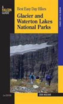
Glacier and Waterton Lakes National Parks
Select Format
Select Condition 
Book Overview
With hikes in Glacier and Waterton varying from half-hour strolls to full-day adventures, this guidebook is for everyone, including families. This description may be from another edition of this product.
Format:Paperback
Language:English
ISBN:076273633X
ISBN13:9780762736331
Release Date:January 2007
Publisher:Falcon Press Publishing
Length:101 Pages
Weight:0.25 lbs.
Dimensions:0.3" x 4.4" x 7.1"
Customer Reviews
5 ratings
great easy hikes
Published by Thriftbooks.com User , 16 years ago
We found this book to be a great resource for trying to cover all areas of the park in only 5 days. We were able to do some hiking in all the main areas of the park and really get to take in some of the great beauty of the park that you just can't see from the road!
Useful Glacier hike planning
Published by Thriftbooks.com User , 16 years ago
Used this a lot to plan day hikes and did many of the listed hikes while at Glacier in July 2008. Distances, times seemed reasonably accurate and comments a good synopsis for the trail. Doesn't rate hikes, "easy", "difficult", etc; but most in Glacier are in the easy-intermediate range anyway. Relatively small size made it easy to take along or fit in pants pocket. Trails in Glacier are well used/marked so you don't really need it during hiking, but I liked it for planning my hikes or referencing when having to change plans during the day. Maybe only thing to add are a few pictures, which can help decide if you want to take a certain trail or not.
Excellent book
Published by Thriftbooks.com User , 16 years ago
Time is at a premium on vacation. I feel that we will see some great views in Glacier using this book and stay within our vacation time period. Thanks for writing this with all the details given. Very helpful.
Very Helpful Trail Guide
Published by Thriftbooks.com User , 17 years ago
Best Easy Day Hikes for Glacier and Waterton Lakes National Parks is a bit misleading as a title. While there are easy hikes, some are far from it. For example, one hike is nine miles long with a 1200-foot climb while another is over 14 miles long. Fortunately, the distances and elevation changes are clearly marked in the description so it is easy to select those you are willing and able to tackle while leaving the others for the more adventurous. There are also maps for each hike but it sometimes took me a while to use them. The actual trail wasn't always well defined within the larger area portrayed on the map and I often found the trailheads especially difficult to spot. It was not a major problem as I always worked it out in the end but it is an area that could use a bit of improvement. There are 28 hikes listed and they are broken down into 5 geographic areas of the two parks. My wife and I did 2-3 hikes from each area and found the descriptions to be both helpful and largely accurate. The book is small enough to easily fit in a hip pocket and held up very well during a full week of heavy usage. Color photos would have been a nice addition but that would have made the book both larger and heavier which is not ideal for a pocket guide. Overall, this was a great purchase at an extremely reasonable price.
Very Good for the Money
Published by Thriftbooks.com User , 25 years ago
Its construction is not as durable as one would like for a reference to carry with you while hiking, but what can one expect for that small an asking price? However, the descriptions and maps for each hike are easy to understand--even for the novice hiker. 25 easy hikes are included in the book, with distance, degree of difficulty, time required, and elevation change included. There are no pictures in the book, but still its very well done.


